Summary
- When the Water System Becomes Less Predictable Here’s the strange part: Pakistan can suffer from both too little water and too much water, sometimes within the same year.
- Increasingly, the issue is not simply how much water Pakistan has, but when it arrives, where it is available and how reliably it can be managed.
- But it can decide how wisely it prepares for the climate, water, energy and security realities that geography now presents.
Most countries live with one major vulnerability they have learned to manage over time. Pakistan’s story is different. Several pressures are building at once, and many trace back to the land, rivers and mountains that have sustained the country for generations. Geography, climate and water sit at the heart of this story, each shaping the others in ways that are easy to overlook until they begin to overlap.
- The Geography That Shaped Pakistan
- When the Water System Becomes Less Predictable
- When Geography Becomes a Question of Security
- Why These Pressures Matter Together
- Navigating the Convergence
Pakistan’s location has been a gift in many ways, giving it fertile plains, mountain-fed rivers and a coastline opening onto the Arabian Sea. But that same geography has also tied Pakistan’s fortunes closely to those natural systems. Beyond the environment, the country’s regional position brings its own pressures.
So the real question becomes this: what happens when the natural systems that have supported a nation for centuries become less predictable? To understand that, it helps to start with the land itself.
The Geography That Shaped Pakistan
Pakistan sits in a genuinely unusual spot on the map. India lies to the east, Afghanistan and Iran border it to the west, China sits to the north, and the Arabian Sea opens up to the south. In effect, Pakistan sits where South Asia, Central Asia and the Middle East come close to meeting. That position has shaped trade, culture and political history for centuries.
Travel across Pakistan and the contrast is striking. In the north stand the Himalayas, the Hindu Kush and the Karakoram, home to glaciers and snowfields that feed the country’s rivers. Move south and the landscape changes completely, opening into the Indus plains, then further out into the dry stretches of the Thar Desert and the rugged terrain of Balochistan. Pakistan holds a striking contrast: abundant water in its northern mountains and naturally water-scarce landscapes across much of the south and west.
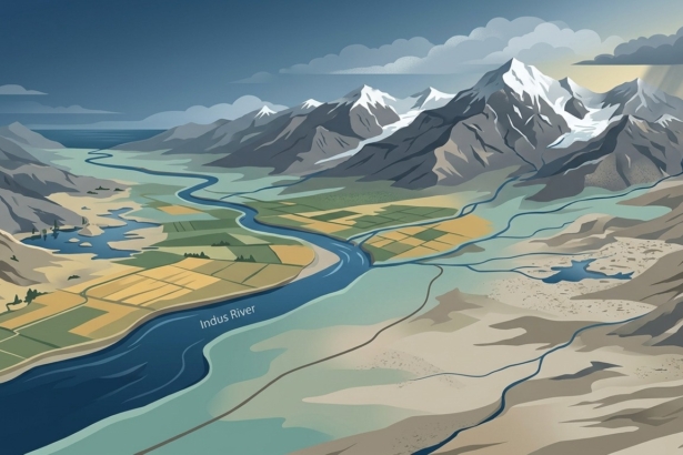
The Indus River is the thread that ties this landscape together. It begins high in the mountains, gathers strength as it moves south, spreads across the fertile plains of Punjab and Sindh, and eventually reaches the sea through the Indus Delta. Because so much of Pakistan is arid or semi-arid, irrigation from this river is not simply useful; it is the backbone of agriculture. The World Bank notes that irrigated land accounts for more than 90 percent of the country’s agricultural output. That level of dependence makes the Indus more than a river; it is part of the country’s economic foundation.
Given all this, it’s no surprise that people, farms and economic activity gathered around the Indus plains. That concentration created a close connection between mountains, rivers, farmland and communities, meaning that changes in one part of the system can eventually be felt far beyond it.
When the Water System Becomes Less Predictable
Here’s the strange part: Pakistan can suffer from both too little water and too much water, sometimes within the same year. Droughts and shortages show up in one season, while irregular rains and destructive floods appear in another. Increasingly, the issue is not simply how much water Pakistan has, but when it arrives, where it is available and how reliably it can be managed. The World Bank expects climate change to make both floods and droughts more variable and more severe going forward.
Much of this begins high in the northern mountains, where snow and glacier melt provide a substantial share of the Indus system’s flow. World Bank estimates put that contribution at between 50 and 80 percent across the Hindu Kush–Karakoram stretch of the Greater Himalayas. As temperatures shift, melting patterns change too, altering when water reaches the rivers below and, at times, increasing certain mountain hazards. The bigger challenge is that the timing and reliability of that supply are becoming harder to predict, making planning for agriculture, energy and communities more difficult.
A recent event in Nepal offers a useful example of how a disturbance high in the mountains can affect communities far downstream. Pakistan should not assume the same event would unfold on its own soil, but the lesson is relevant: disturbances that begin in mountain regions can have consequences far beyond where they start.
Beneath all of this sits another resource that often goes unnoticed. Groundwater supplies around 70 percent of Pakistan’s domestic water needs and more than half of what its farms use. It acts as a critical buffer when surface supplies fall short. But that buffer is under strain from over-pumping, contamination, waterlogging, salinity, and monitoring systems that haven’t kept pace with demand. The concern is therefore not only how much water remains underground, but whether that reserve can continue to support people and farms.
There is another part of the water story that is easy to overlook: energy costs. Even when water is plentiful, Pakistan’s hydropower generation did not rise over the years. Reservoir management, seasonal flows, transmission bottlenecks and other power-sector constraints can leave cheaper hydropower underused, forcing greater reliance on more expensive sources of electricity.
The consequences extend beyond household electricity bills. Higher power costs raise the cost of production for factories, weaken the competitiveness of Pakistani goods and can ultimately make it harder for exporters to compete in international markets.
Follow that water downstream, and the effects appear across farmland, ecosystems and communities before eventually reaching the coast.
When Geography Becomes a Question of Security
The Indus does not begin or end at Pakistan’s borders. It is part of a wider Himalayan river network linking several South Asian countries, making its management inseparable from regional relationships. The Indus Waters Treaty is a good example of why shared water needs shared rules.
India’s decision in 2025 to place the Indus Waters Treaty in abeyance has added a new layer of uncertainty to Pakistan’s water security. Any sustained reduction, disruption or greater unpredictability in flows reaching Pakistan would be particularly serious for agriculture, which depends heavily on the Indus irrigation system. Even before any major physical reduction in water availability, uncertainty over upstream releases, reservoir operations and the future of the treaty framework could make it harder for farmers to plan crops, manage irrigation and protect yields. For a country already facing climate-driven water variability and pressure on its groundwater reserves, the weakening of a decades-old water-sharing framework could turn water security into an increasingly difficult economic and strategic challenge.
Pakistan’s neighbors also have interests that extend well beyond water. China has major economic and strategic interests in the country; Afghanistan is closely tied to Pakistan through security, trade and migration; Iran through border security, trade and energy; while India has deep interests in security, trade and the wider Indus system. These interests do not always align, which makes Pakistan’s geography both an asset and a source of strategic pressure.
Why These Pressures Matter Together
Pakistan’s challenges rarely come from one border or one type of risk alone. They place additional demands on institutions, infrastructure and public finances already under strain. Economic and security concerns, institutional weakness and declining public trust add another layer of difficulty. The greater concern is what happens when several arrive at the same time.
Climate variability can make water supplies less predictable. That uncertainty puts pressure on agriculture, while growing cities increase demand for reliable supplies. When surface water falls short, dependence on groundwater grows. At the same time, groundwater can come under pressure while floods expose weaknesses in infrastructure and planning. At the coast, sea-level rise, saltwater intrusion and storms add another layer to the challenge.
No single link in that chain guarantees a crisis. The deeper concern is the accumulation: one pressure landing on another until problems that were once manageable become much harder to absorb.
Navigating the Convergence
None of this means Pakistan is destined for collapse. It means the country is entering a more demanding chapter, one in which climate, water, energy and security pressures increasingly intersect around the systems that have sustained it for generations.
Pakistan cannot rewrite the geography it was given. But it can decide how wisely it prepares for the climate, water, energy and security realities that geography now presents.
We welcome your contributions! Submit your blogs, opinion pieces, press releases, news story pitches, and news features to opinion@minutemirror.com.pk and minutemirrormail@gmail.com